
La Cloche Silhouette Trail: 7 Amazing, Essential Tips
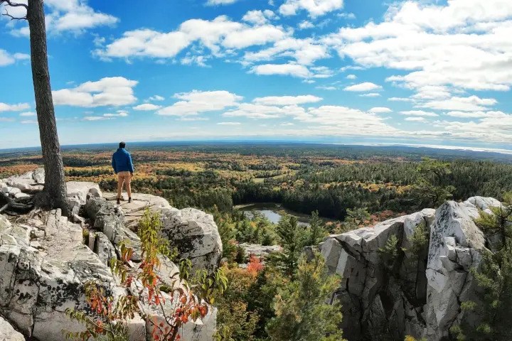
The La Cloche Silhouette Trail is a strenuous 80-kilometre loop in Killarney Provincial Park that usually takes seven to ten days. It suits fit hikers with backcountry skills, not first-time campers seeking an easy trek. You must reserve each campsite, carry all supplies, and prepare for steep climbs.
The route crosses forest, wetlands, creeks, and bright quartzite ridges. Those pale ridges inspired Group of Seven painter Franklin Carmichael. The trail takes its name from his painting, La Cloche Silhouette. Planning well can turn a hard week into a great one.
These seven tips cover the choices that matter most.
1. Book Your La Cloche Silhouette Trail Campsites First
Book through the Ontario Parks reservation system before planning daily distances. Reservations open up to five months before your arrival date. The system assigns a specific campsite for every night, not just a general camping zone. That detail changes your whole plan. You cannot hike until you feel tired, then claim any open site. Your reserved sites set each day’s route and distance. Also, remember that camping is only allowed at designated sites.
Popular dates can vanish soon after the booking window opens. September weekends draw hikers seeking cool air, fewer bugs, and fall colour. Sites near Silver Peak and the eastern ridges can also shape many plans. Therefore, start with two or three possible date ranges. Then build a route around campsites that match your pace. Do not force huge days simply because those sites remain open.
The trail begins and ends near George Lake Campground. Backcountry permits must be collected during check-in where required. Carry your reservation details in print and on your phone. Ontario Parks currently lists the route as advanced and confirms that specific campsites can be booked online.
2. Pick Your Direction With Care
Clockwise travel is the better choice for most first-time hikers. It gives you gentler terrain during the early western section where your body can adjust before the route reaches its toughest ridges. You also save The Crack for the final part. By then, your food bag feels much lighter, and your balance and trail legs should also feel better.
Clockwise travel also makes several rough slopes easier to handle. Local outfitters cite loose scree, talus, and safety concerns when recommending this direction. Still, rain can change any descent within minutes.
Going counter-clockwise puts steep ground near the start. You may climb through The Crack while carrying a full pack. Does that sound like the best first morning? For most hikers, it is an avoidable test.
Counter-clockwise travel can still suit skilled backpackers. Some prefer tackling hard ground while their legs feel fresh. Yet fresh legs do not cancel a heavy pack or slick quartzite.
Study a current park map before booking. Mark every campsite, water source, steep section, and side trip. Phone service may be weak or absent, so offline navigation matters.
3. Give the La Cloche Silhouette Trail Seven to Ten Days
Allow seven to ten days for the complete loop. Ontario Parks gives the same range and rates the route as strenuous. Five days may be possible, but it leaves little room for delays. But going here just by calculating distance alone gives the wrong idea. Ten kilometres on flat ground can feel easy. But ten kilometres over wet roots, boulders, and sharp ridges feels quite different.
Shorter days also leave space for weather changes. A storm may make exposed white rock slick and unsafe. Rushing to a booked site can then push hikers into poor choices. Seven days suits strong hikers with light packs while eight or nine days gives many people a saner pace. Finally, ten days works well for careful hikers who want rest and swim time.
But is it okay for beginners? A new backpacker should not make this a first overnight trip. Complete shorter routes first and practise hiking with a loaded pack. Altitude is not the main problem here. The mountains are low compared with the Rockies. The strain comes from repeated climbs, rough ground, and long days.
4. Prepare Differently for The Crack and Moose Pass
The Crack and Moose Pass get called the hard parts. Therefore, they should not be treated as the same challenge, as each tests your body in a different way. The Crack is mainly a balance and movement problem. Large boulders require careful foot placement and steady hands. A tall pack can shift as you squeeze, climb, or step down.
Wet rock makes this area far more risky. Ontario Parks advises hikers to reconsider The Crack during rain, strong winds, or storms. Its exposed ridges also create lightning risks. Moose Pass is more of an endurance test. The climb feels steep, long, and tiring. It can arrive after earlier terrain has already drained your legs.
Use slow, short steps on the climb, eat before you feel empty, and drink before thirst builds. Trying to charge uphill often leads to a long stop later. Trekking poles can steady you on climbs and wet ground, and you may need to stow them during hands-on scrambles. Gloves can also protect your palms from rough stone.
5. Pack for Wet Feet and Cold Nights
People often pack too much camera gear for Killarney’s views. Yet dry socks will feel far more precious by day three. The route crosses wetlands, creeks, mud, and rough shorelines. Wet feet can lead to blisters and soft skin. Change into dry socks at camp whenever possible and air your feet and shoes while preparing dinner.
Weather can also shift fast near the ridges. A warm afternoon may end with a cold, windy night; therefore, pack layers instead of relying on one thick coat.
Focus on trail-specific gear:
- Sturdy hiking shoes: Choose footwear with grip and enough toe room.
- Trekking poles: They help at creek crossings and on steep descents.
- Dry socks: Keep one pair sealed for sleeping at camp.
- Rain protection: Carry a rain jacket and waterproof pack liner.
- Warm layers: Pack a fleece and light insulated jacket.
- Navigation tools: Bring a current map, compass, and offline route.
- Emergency gear: Carry first aid supplies and a communication device.
Keep your pack as light as safety allows. Every extra item follows you over each ridge. Therefore, test the full load on local hills before leaving Toronto.
6. Treat All Water and Store Food Safely
Treat every drop collected along the route. Clear lake water may still contain parasites or harmful germs. Its colour and taste cannot prove that it is safe. Ontario Parks recommends a proper filter, chemical treatment, or boiling. Its current safety guidance says boiling should continue for at least five minutes. Carry a backup method in case your main filter breaks.
Some campsites have awkward water access. A steep or muddy bank can turn a simple refill into work. So, carry enough capacity to reach the next reliable source. Two one-litre bottles often give one hiker useful flexibility. Add a collapsible container for camp cooking. Do not depend on an unverified stream shown in an old trip report.
Food storage needs the same care. Black bears live in the park, while mice and other animals raid packs. Store food, rubbish, toothpaste, and scented items away from your tent.
Also, cook away from your sleeping area. Pack out scraps and rubbish instead of burying them. Ontario Parks also advises keeping grey water at least 30 metres from campsites and water sources.
7. Time Your Trip Around Bugs and Weather
September is often the best month for this trek. Days tend to feel cooler, biting insects ease, and fall colour may begin. The trade-off is colder nights and less inviting swimming. However, late September can feel calm and crisp. Yet daylight shrinks, nights cool quickly, and storms still occur. Fall hikers need warmer sleep systems and firm turnaround times.
June often brings blackflies and mosquitoes. Wet ground and high insect activity can make camp chores miserable. A bug net is not excessive then. It is peaceful in mesh form. July offers warmer lake water and long daylight. It can also bring heat, insects, and busy booking dates. August often gives a useful balance, though mosquitoes may remain.
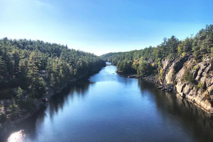
Make sure to check park alerts and fire restrictions before departure. Also, review the forecast again at George Lake. Conditions can change after the long drive from Toronto. For hikers unsure about the full loop, Toronto Eco Adventures offers a Killarney and French River day tour. It includes the demanding seven-kilometre Crack hike and transport from Toronto. The tour does not cover the full backcountry loop, but it offers a useful test before making a longer commitment.
Make the Route Match Your Skills
The La Cloche Silhouette Trail does not require high-altitude training. It demands sound judgement, steady fitness, and careful route planning. The best gear cannot fix rushed campsite choices or an unsafe schedule.
Remember to cook the right route, choose a suitable month, and train beforehand. Give the landscape enough time to reveal itself. The goal is not merely to finish, but to finish wanting to return.
FAQs
Q1: How difficult is the La Cloche Silhouette Trail?
It is an advanced, strenuous backpacking route. Expect steep climbs, boulder scrambles, wet ground, creek crossings, and long days with a loaded pack.
Q2: How long does the complete trail take?
Most hikers need seven to ten days. Fit, skilled hikers may finish sooner, but a fast plan leaves little room for bad weather.
Q3: Can a beginner hike the trail?
It is not a good first backpacking trip. Beginners should gain camping, navigation, food-storage, and loaded-pack experience on shorter routes first.
Q4: Do hikers need a guide?
A guide is not required, but strong navigation and backcountry skills are. Less experienced hikers should train with skilled companions or take a demanding Killarney day hike first.