
7 Mono Cliffs Hiking Trails for a Breathtaking and Unforgettable Ontario Adventure
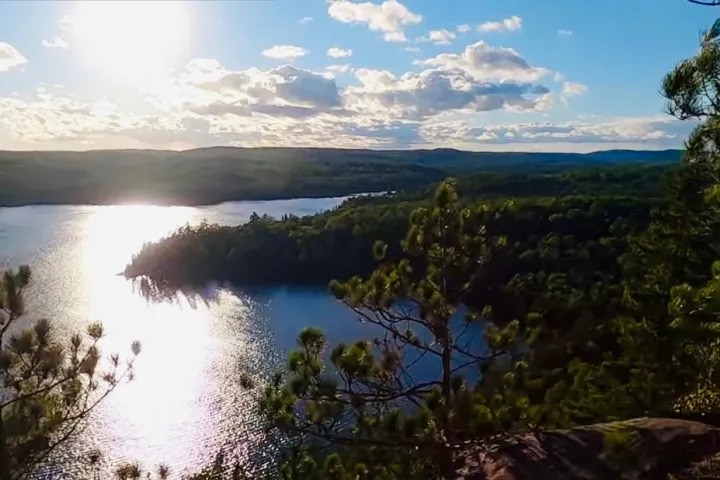
Located near Orangeville, Mono Cliffs Provincial Park protects part of the Niagara Escarpment. Its trail network includes routes from 600 metres to 4.8 kilometres long. You can enjoy a short family walk or join several paths for a full-day hike.
The best Mono Cliffs hiking trails take you past tall cliffs, deep woods, a quiet lake, and wide escarpment views. Most visitors should start with the Cliff-Top, Spillway, and Walter Tovell trails. Together, they reveal what makes this small Ontario park so special.
The park is open year-round for day use. Yet each season brings different trail conditions. Spring can be muddy, summer weekends get busy, and winter paths may be icy.
Why Hike at Mono Cliffs Conservation Area?
The main draw is variety. One minute, you are walking through a bright maple forest. Soon after, you may find yourself beside mossy rock walls that feel far removed from southern Ontario.
The landscape is also rich in plant life. Ferns and old cedars grow around the cool escarpment slopes. Parts of the route pass cliffs rising about 30 metres, while the Spillway Trail enters a narrow canyon-like area.
These trails suit many skill levels, but “easy” does not mean effortless. Roots, stairs, mud, and slick rock can slow your pace. Good shoes matter more here than high-end hiking gear.
1. Cliff-Top Side Trail: Best for Escarpment Views
Distance: 2.8 kilometres
The Cliff-Top Side Trail is one of the best Mono Cliffs hiking trails for first-time visitors. It leads through mature woods and past the park’s famed escarpment features. Viewing areas offer glimpses across the land below.
Do not expect a wide-open mountain peak. The forest frames many of the views, which gives the path a calm feel. In autumn, red and gold leaves make the route even more striking.
This trail has steps and some uneven ground. Therefore, take your time after rain, since wet leaves can hide slick roots. It works best as part of a longer loop with the Spillway or McCarston’s Trail.
2. Spillway Trail: Best for Rock Walls and Drama
Distance: 1.3 kilometres
The Spillway Trail delivers a lot in a short distance. It passes through the park’s rocky canyon, where steep walls rise beside the path. Cool air often settles between the rocks, even on a warm day.
Why choose this route? It gives you the park’s most distinct experience without a long trek. Walking through the narrow passage feels like entering a hidden room in the escarpment.
The route may be damp or muddy, and rocks and timber steps can also feel slick after rain. Walk with care and stay on the marked path to protect the fragile plants.
3. Walter Tovell Trail: Best for a Longer Forest Walk
Distance: 4.8 kilometres
Walter Tovell is the longest named route at Mono Cliffs Conservation Area. It follows low ground beneath parts of the escarpment. The path offers deep forest, wetland views, and a slower pace than the busy lookout areas.
This is a good pick when you want distance without steep climbs all day. Yet the route can hold water after rain or snowmelt. Waterproof hiking shoes save you from finishing the walk with cold, wet socks. The trail also connects well with other park paths. Strong hikers can pair it with the Cliff-Top and Carriage trails.
4. McCarston’s Trail: Best for a Quiet Lake Loop
Distance: 3.6 kilometres
McCarston’s Trail loops around a small kettle lake formed by past glacial activity. The water is not a beach or picnic lake. Instead, it is a quiet natural feature surrounded by woods and wet ground.
This route feels less dramatic than the Spillway Trail and suits visitors who enjoy bird calls, soft forest light, and fewer busy viewing stops. Allow more time than the distance may suggest. Mud and roots can slow your pace, while the lake area invites frequent pauses.
5. South Outlier Trail: Best for a Peaceful Woodland Hike
Distance: 3.5 kilometres
The South Outlier Trail explores the quieter southern part of the park. Its rolling forest path feels more like a classic Ontario woodland walk. It is a fine choice when the main cliff routes feel crowded.
The terrain has gentle rises, but it can still test tired legs. Fallen leaves may cover stones and roots in late autumn. Keep a steady pace instead of rushing to complete the loop.
This trail also overlaps with the Bruce Trail corridor in places. Watch for trail markers at each junction. Recent signage and blazing changes make the current park map more reliable than an old blog screenshot.
6. Carriage Trail: Best Short Connector
Distance: 1.3 kilometres
The Carriage Trail is short, yet it plays a key role in many Mono Cliffs hiking trails. It helps connect the parking area with routes near the escarpment. The path is often used as one section of a larger loop.
It is a smart option when hiking with children or unsure walkers. You can start here, check how everyone feels, and then extend the outing. That flexibility helps prevent a fun day from becoming a forced march.
7. Lookout Trail: Best Quick Scenic Detour
Distance: 600 metres
The Lookout Trail is the shortest route on this list. It offers a quick detour for hikers who want a scenic stop without adding several kilometres. It is also useful when daylight or energy begins to run low.
Short does not always mean flat. Here, you can expect natural ground and possible changes in height. Someone with limited mobility should check current conditions before choosing it. Spend a few quiet minutes at the viewing area. Then let the next group enjoy the space.
How to Plan Your Visit
Mono Cliffs Provincial Park uses an automatic entrance gate. Visitors should first get a daily vehicle permit before arriving. The barcode from the permit is scanned at the gate.
Permits become available up to five days before a visit. Ontario Parks says advance booking is required to guarantee access because parking is limited. Some permits cover a set time slot, so confirm the hours before leaving home.
Before your hike:
- Download or photograph the official trail map.
- Check the forecast and park alerts.
- Bring water, snacks, and a charged phone.
- Wear shoes with firm tread.
- Pack a light rain layer.
- Carry traction aids during icy months.
- Leave enough daylight for the return walk.
The park has no campground and is designed for day use. Cell service may also be weak in places. Tell someone your planned route if you are hiking alone.
Best Time to Hike at Mono Cliffs Conservation Area
Late spring through autumn offers the easiest hiking conditions. Summer brings green forest and long daylight. Fall adds rich colour, but it also draws the largest crowds.
Weekday mornings often feel calmer than sunny weekend afternoons. An early start also gives you more freedom to link several routes. Just remember that shaded ground may remain wet after overnight rain.
Winter creates a very different trip. Snowshoeing and cross-country skiing are allowed on hiking paths, but the trails are not groomed or track-set. Check the Ontario Parks activity information before a cold-weather visit.
Explore More Ontario Trails With Toronto Eco Adventures
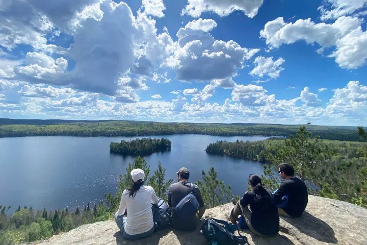
Mono Cliffs is easy to explore on your own if you have a car and a clear route plan. But some hikers prefer guided trips, small groups, and transport from Toronto. This can remove much of the stress from planning a longer Ontario adventure.
After exploring the Mono Cliffs hiking trails, you can discover more of the province with Toronto Eco Adventures. Its Centennial Ridges Hike in Algonquin Park features a demanding 10.4-kilometre route with scenic ridge views. It is a strong next step for hikers ready for a bigger challenge.
For a trip that mixes land and water, consider the Bon Echo Hiking and Canoeing Adventure. This day tour combines hiking with canoeing on Mazinaw Lake. Visitors can see the park’s striking rock face and Indigenous pictographs from the water.
Both trips offer a different experience from Mono Cliffs Conservation Area. Centennial Ridges raises the physical challenge, while Bon Echo adds time on the lake.
Make Your Mono Cliffs Adventure Count
The finest Mono Cliffs hiking trails are not always the longest ones. Cliff-Top brings the views, Spillway supplies the drama, and Walter Tovell offers room to roam. McCarston’s and South Outlier reward hikers who value quiet over speed.
Book your permit, take a current map, and choose a route that fits your group. There is no need to conquer the whole park in one visit. After all, is leaving one trail for next time really such a bad thing?
FAQs
Q1: Are Mono Cliffs suitable for beginner hikers?
Yes. Beginners can enjoy the Carriage, Lookout, and Spillway trails at a relaxed pace. Uneven ground, stairs, mud, and winter ice may still pose challenges.
Q2: How long does it take to hike Mono Cliffs?
A short outing may take one or two hours. A joined loop can take three to five hours, depending on distance and stops. Always allow extra time for wet or icy ground.
Q3: Do you need a permit for Mono Cliffs Provincial Park?
Visitors arriving by vehicle need a valid daily vehicle permit. Booking ahead guarantees entry because the car park has limited capacity. Permits are released up to five days before arrival through Ontario Parks reservations.
Q4: Are dogs allowed on the trails?
Dogs are allowed in permitted areas but must stay under control. They must be on a leash no longer than two metres. Owners must remove pet waste and protect wildlife.
Q5: Is camping available at Mono Cliffs?
No. Mono Cliffs is a day-use park without a campground. Visitors seeking an overnight stay should find lodging or camping elsewhere in the region.